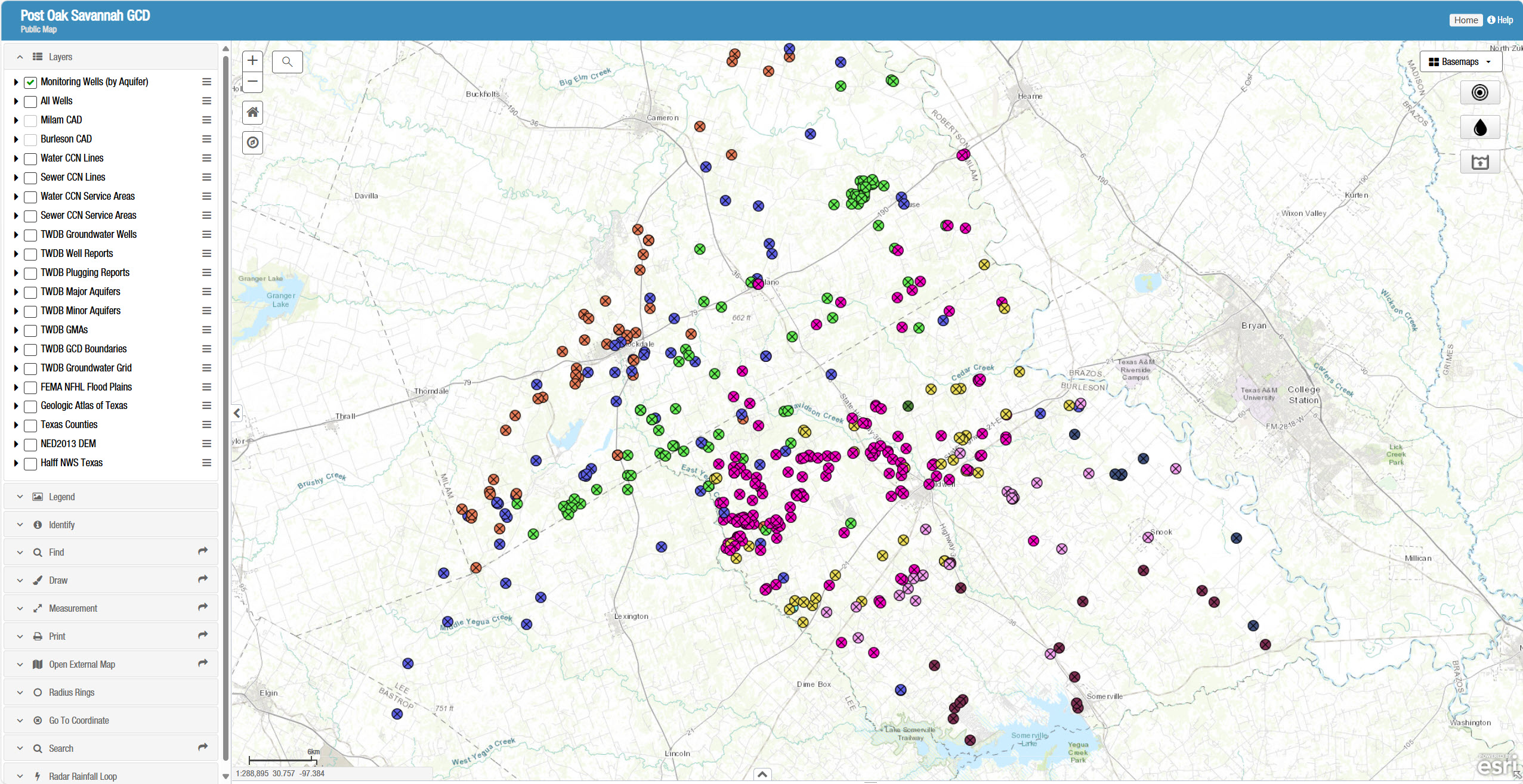
Welcome to our Interactive Public Maps
Explore groundwater resources like never before with our Interactive Public Maps. This tool provides easy access to well locations, water level data, aquifer information, and other important details across our region.
Using a variety of layers and mapping tools, you can:
- View individual well sites and monitoring data
- Explore aquifer cross-sections and elevations
- Access real-time and historical water level measurements
- Customize map views with different data layers
Whether you’re a researcher, a landowner, or simply curious about groundwater in our area, the Interactive Public Maps make it easy to visualize and understand the information in our system.
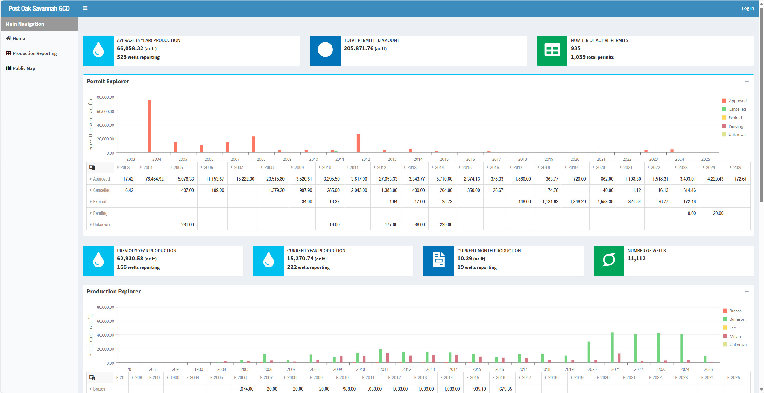
Public Maps
Dashboard
If you have a specific question on using these tools, email: mredman@posgcd.org